4Application
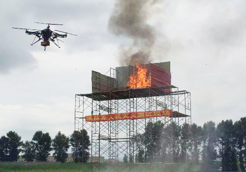
With the maturing of UAV technology and the further development of aerial photography technology, the applications of civil UAVs are becoming more and more widespread, including power line patrol, emergency rescue and disaster relief, resource exploration, environmental monitoring, natural disaster monitoring and assessment, forest fire and insect pest protection And monitoring. Among them, the task of forest fire prevention is getting more and more serious. The fire fighting forces in our country are faced with complicated fire fighting and rescue and social assistance situations. The limitations of traditional on-site investigation methods have become increasingly prominent. At the same time, a large amount of manpower, material and financial resources are also expended in forest fire fighting. The damage caused to the destruction of forest resources and ecological environment is immeasurable. Therefore, how to apply high-tech means to forest resources monitoring, effectively implement fire early-warning and on-site detection, and quickly and accurately dispose of the disaster has become an urgent and urgent issue to be solved in forest fire prevention work. First, the foreign forest fire safety technology Canada uses the launch of electromagnetic radiation from the satellite forest temperature, when detected in the forest area temperature rose to 150 ℃ ~ 200 ℃, infrared wavelength up to 3.7 microns, is a precursor of fire, immediate determination of specific Temperature, take timely measures to prevent fire.